Teaching Philosophy
The beauty of Earth science is that we can learn from everything around us. Geology controls where, how, and what we can build and provides us with the energy and materials that shape out world. In my courses I strive to use real-world examples with a local emphasis to help my students connect with their readings and course concepts. Depending on a student’s background, the field can either be a draw or a barrier to entry. I worked with my colleagues in the department and CATS to generate virtual field trips (link) to help introduce students to the landforms that surround them and get them thinking like a field scientist. I specialize in sedimentology, structural geology, and field mapping, so I teach all of those courses along with our introductory physical geology classes, depending on the semester.

Image from field camp exercise in ogden canyon.
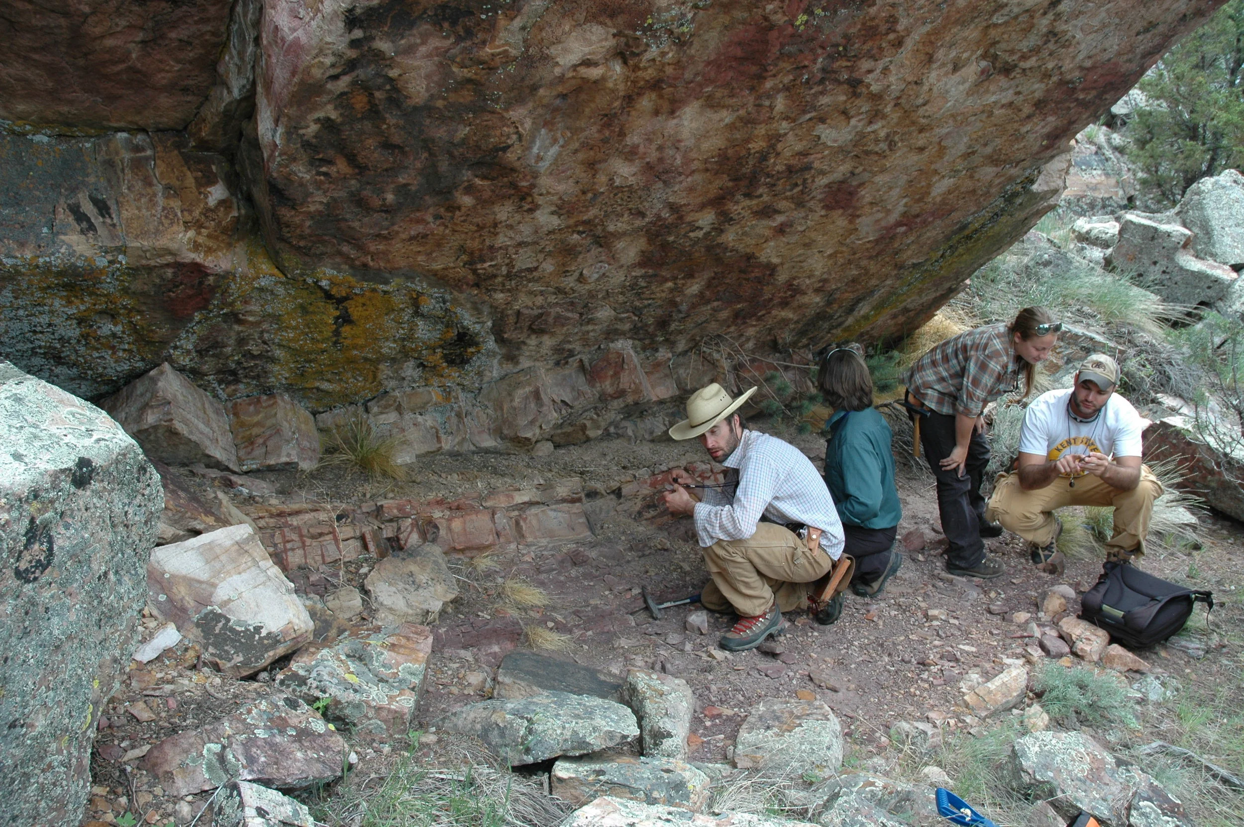
measuring section and looking for trace fossils in southwestern montana.
I have been extremely lucky to work under and learn from an incredible collection of mentors who have shaped my world view and teaching style. My academic experience has been influenced by professors who emphasized thorough scientific investigation, a collaborative atmosphere, and the importance of teaching in scholarship. I am continuously inspired by the work ethic and intellectual enthusiasm demonstrated by those I work with, and I try to pass that enthusiasm on to my own students.
Experience
Most of my courses are in-person, but I have taught the majority of them in hybrid or fully online (mostly thanks to COVID). Teaching my courses in multiple formats required me to improve my materials and update my pedagogies. Weber is a primarily undergraduate institution and I teach 2-3 courses per semester, generally with associated labs.
Classes
Sedimentology and Stratigraphy
As a tectonic sedimentologist, this is one of my favorite classes to teach and the one I have been teaching the longest. I started my teaching adventures as a sed strat TA at Idaho State during my Master and the University of Arizona during my PhD. I consistently teach sed strat every spring at WSU and lead local field trips in the northern Wasatch as well as a long weekend trip to Moab and central Utah. I think sedimentology is best learned through a combination of time spend in modern river/marginal marine environments, watching bed forms migrate in real time combined with large-scale outcrop exposures that give 3D views of both large- and small-scale sedimentary structures.
I had a great time teaching a block for Colorado College in the Spring of 2015. The class included a 2 week field trip around New Mexico moving from the Raton Basin at the CO/NM border, to the Caballo Range in southwestern NM, east to the Permian Reef, Carlsbad Caverns and the Delaware Basin before a long trip north to learn about volcanoclastic depositional systems near the Valles Caldera.
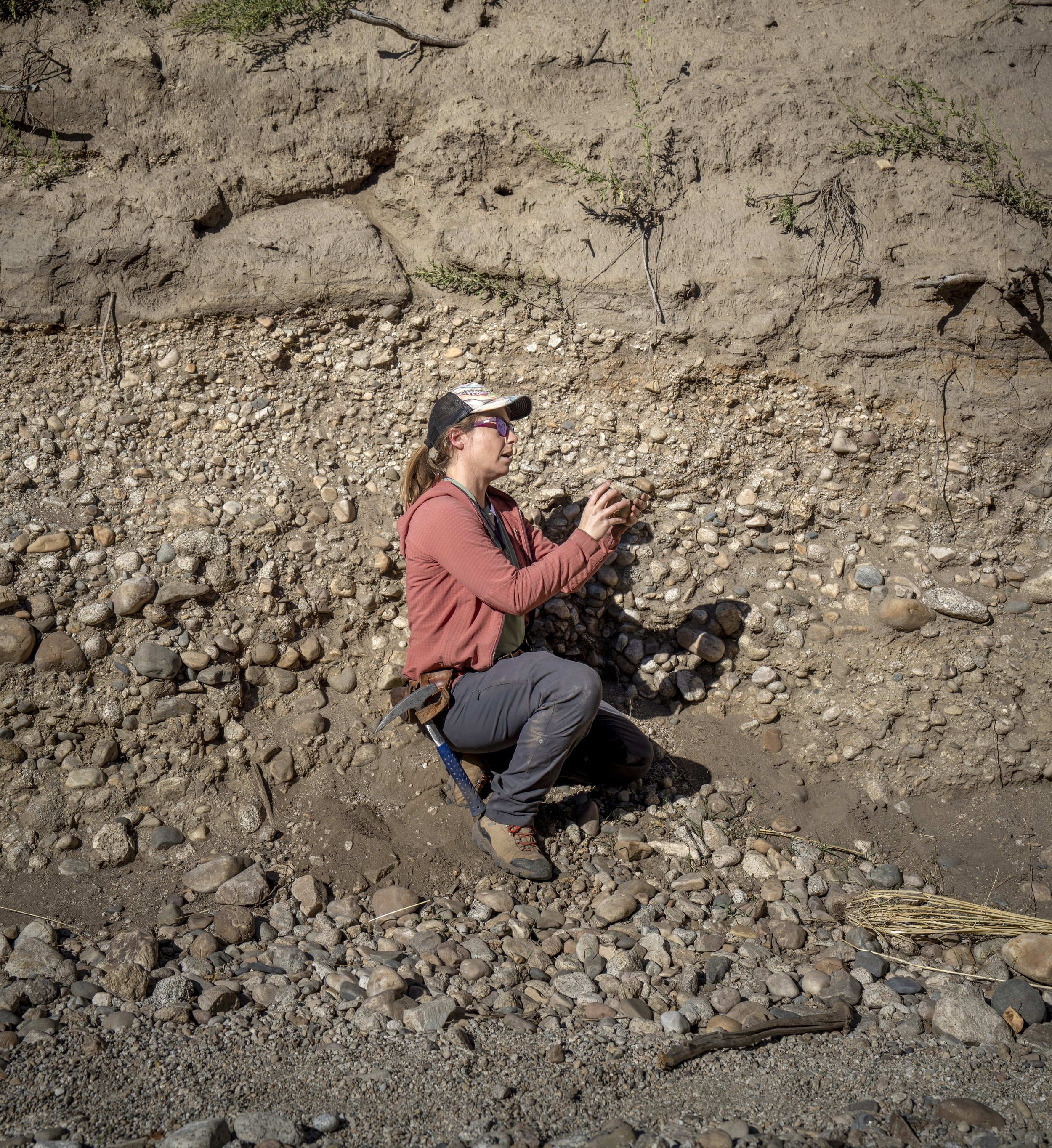
photo showing imbrication along a fluvial deposit near salt lake city, ut.
Historical Geology
I have taught Historical Geology as both a capstone class (400-level), after the majority of other geology classes have been taken, and as a second introduction (usually just after the required GEO 100 class) to geology. Since my main focus is on sedimentology and tectonics I like to use the geologic history of North America, starting with the Archean core and working both out (looking at accretionary history) and up (stratigraphically!), as a recurring theme in a Historical class. I think it is incredibly important for my students to have an understanding of both the local geology where they live/work and the geologic history of the Earth. I link the tectonic evolution of the Earth to the evolution of the atmosphere and biosphere, particularly during the Phanerozoic. My own research on Neoproterozoic-Cambrian evolution and stratigraphy of northern Utah is integrated into my Historical Geology course. I have run a field trip to Antelope Island State Park, highlighting the Paleoproterozoic-Neoproterozoic evolution of western North America, along with Sevier deformation, Neogene tectonics and the beautifully exposed Bonneville shorelines from the last glacial maximum. Integrating the evolution of the Earth with world-class local exposures helps put the local geology into the global system, building a narrative to help students retain and build their geologic understanding.

group photo near corona arch outside moab, ut. we visited this area on a joint field trip to learn about the geologic history of central utah.
Field Methods and Field Camp
At Weber State we have a two-part field program with a semester long Field Methods course required for all Earth Science majors and a traditional 4-week summer field camp required for Geology majors. Field Methods has a 5-hour Friday lab where we use the natural laboratory of the northern Wasatch to learn how to map bedrock and surficial deposits. Projects are then related to local water and economic resources as well as geologic hazards.

Photo a field methods geologic hazards mapping activity in bells canyon near salt lake city, ut.
Along with field work, students learn how to use multiple types of analytical geoscience equipment to help them build their geoscience toolkit. Field context and mapping is the primary focus, but they also learn how to collect, process, and analyze samples to answer specific geologic questions. Some students have continued those project in independent or group projects that they then completed and presented at regional or national geoscience meetings.

a student weighing out rock powder to make a glass bead to be run for whole rock geochemical analysis as a part of the Field methods course.
In addition to various field projects in Utah I have taught field camp or field camp exercises in New Mexico, Montana, and Idaho. I think field camp is an incredibly important formative experience for undergraduate geologist when they are able to fully immerse themselves in the geology and learn to work well with others. I find that starting students with detailed (old school) field mapping, with paper, pencil and Brunton, for early projects and then "graduating them" to the digital world, where they will fully utilize technology (GSP and GIS). They are required to produce both a paper field map and a final digital map at the end of each exercise. The initial period of time where students are forced to read the topography to both locate themselves and geologic structures is paramount to their spatial growth and understanding of a regional geologic system.
Mapping with students along the jefferson river in southwestern Montana.
It’s important to remember that students are learning how to build their spatial-structural awareness along with learning how to read landscapes. Eventually, in their work, they will likely have access to digital tools, which will streamline digital publication and documentation of their work. However, if they use those tools too early they will not develop their own spatial awareness and it will hinder their growth as an Earth scientist.
Physical Geology Lecture and Lab
This is our introductory geology series required for all Geology and Environmental Science majors and commonly taken as a physical science general education lecture and lab by many other students. Students learn the basics of rock and mineral identification though the lens of plate tectonics. The study of geology is all about being able to read the story of a landscape and use it to understand geologic resources and hazards. All people benefit in a better understanding of Earth’s interrelated systems and I enjoy sharing my love of geology with students of all backgrounds.
Over the last two years we have fully updated our intro series using an open access online textbook for our lecture and all of our own materials for the lab. Make material accessible (free) and tailored to local geology helps connect students with their local geology. I also developed virtual field trip to help with rock identification, the identification of geologic structures in the field, and local geologic hazards on the Wasatch Front.
Field Seminar Courses
The best geologist is the one who has seen the most rocks! To add to that common sentiment, the best place to see rocks is in their natural habitat! Hand samples have their place, but so much of the depth and grandeur of the Earth is only captured in the mountains and valleys that tell its story.
I have led field trips to regional National Parks including Yellowstone, Bryce Canyon and Zion. I also led research-based courses in the Wasatch Mountains watershed culminating in collecting water samples from the Great Salt Lake.
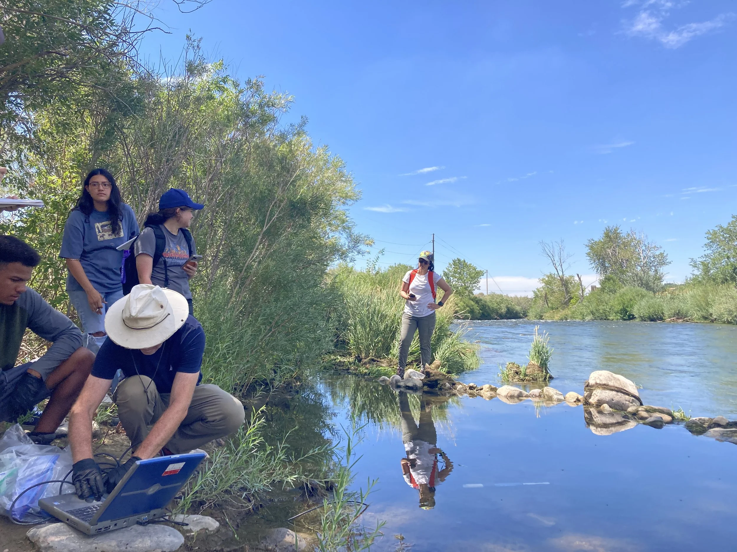
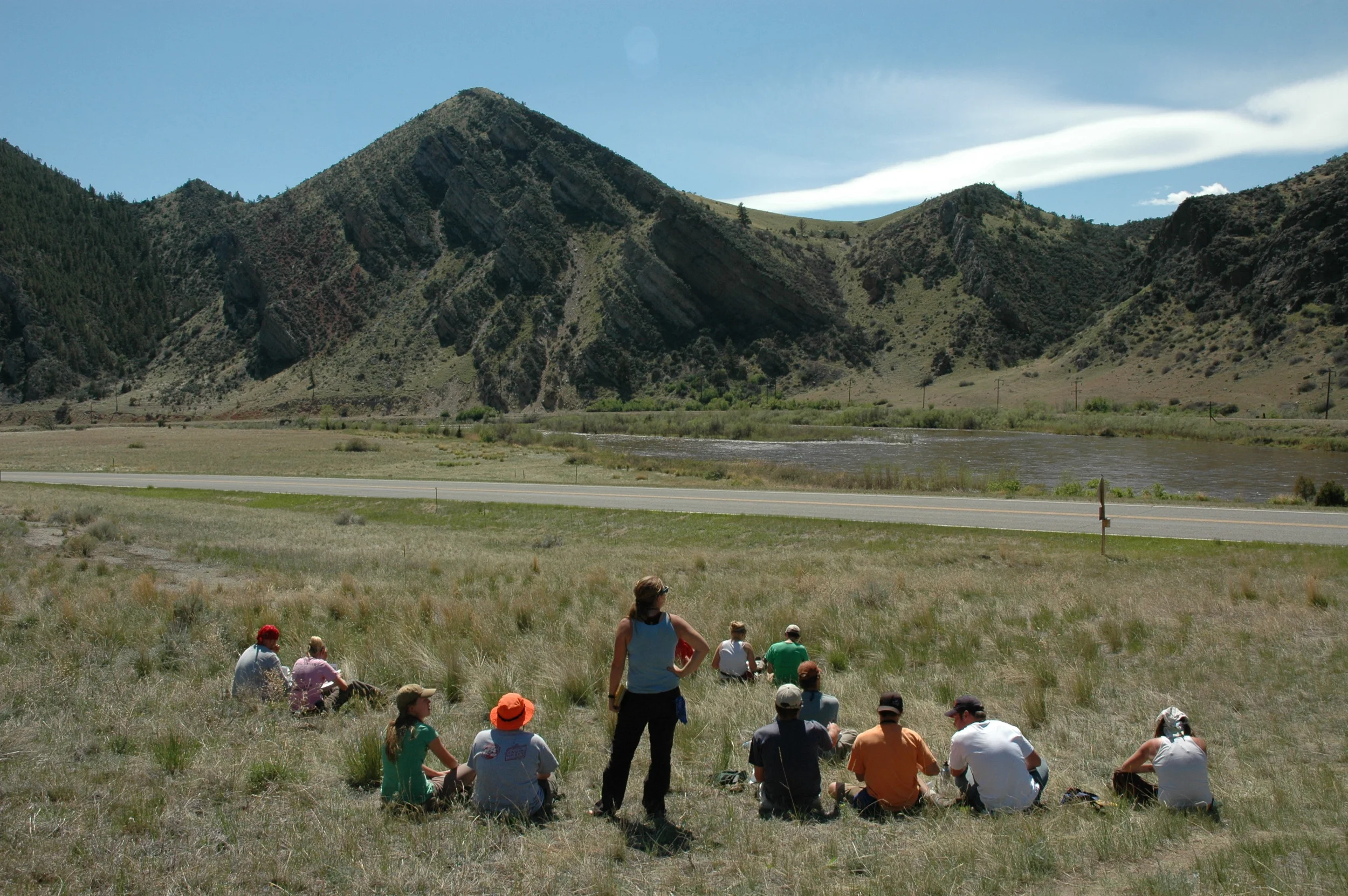
students collecting field data along the weber river, just south of weber state campus.
Iceland, the land of fire and ice. I co-led a field trip to Iceland in 2019 with my hydrologist colleague. We took 10 students to Iceland and traveled around the southern and central part of the Island. Students learned about the soggy, freezing, and explosive history or the island while also collecting water and rock samples to bring back to weber and analyze to provide additional context for what they learned on the trip.
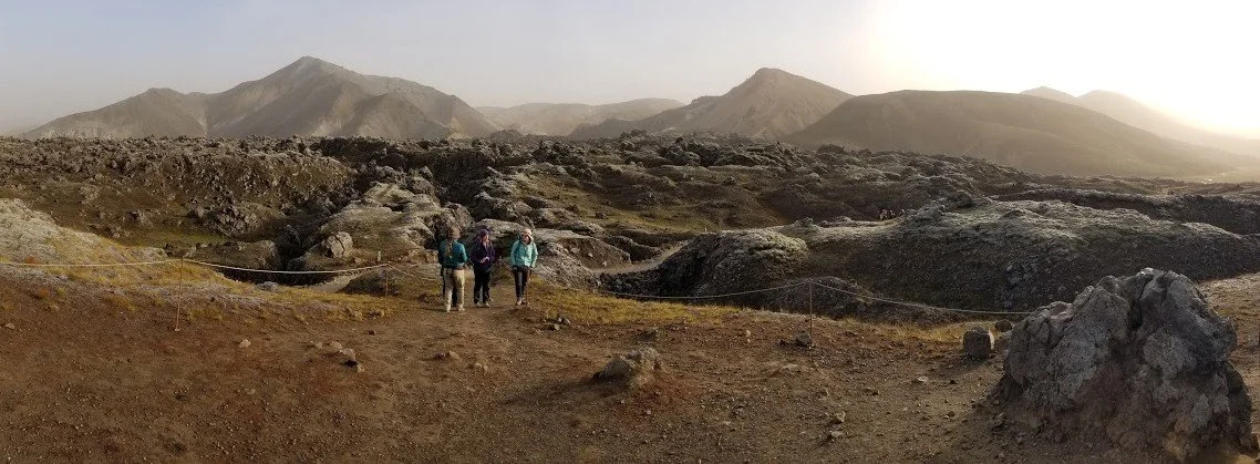
walking throug lava fields in central iceland.
During the summers of 2016, 2017, and 2018 I traveled to Peru with various students from Weber State University and we met up with a group of students and faculty from Western Washington University (WWU). We spent five-six weeks in the Cordillera Blanca mapping valleys and collecting rock samples. We also assisted the students from WWU as the collected water samples from the same drainages where we were mapping. This field experience was a course for WWU students and independent research for WSU students. See more details about research outcomes in that tab.
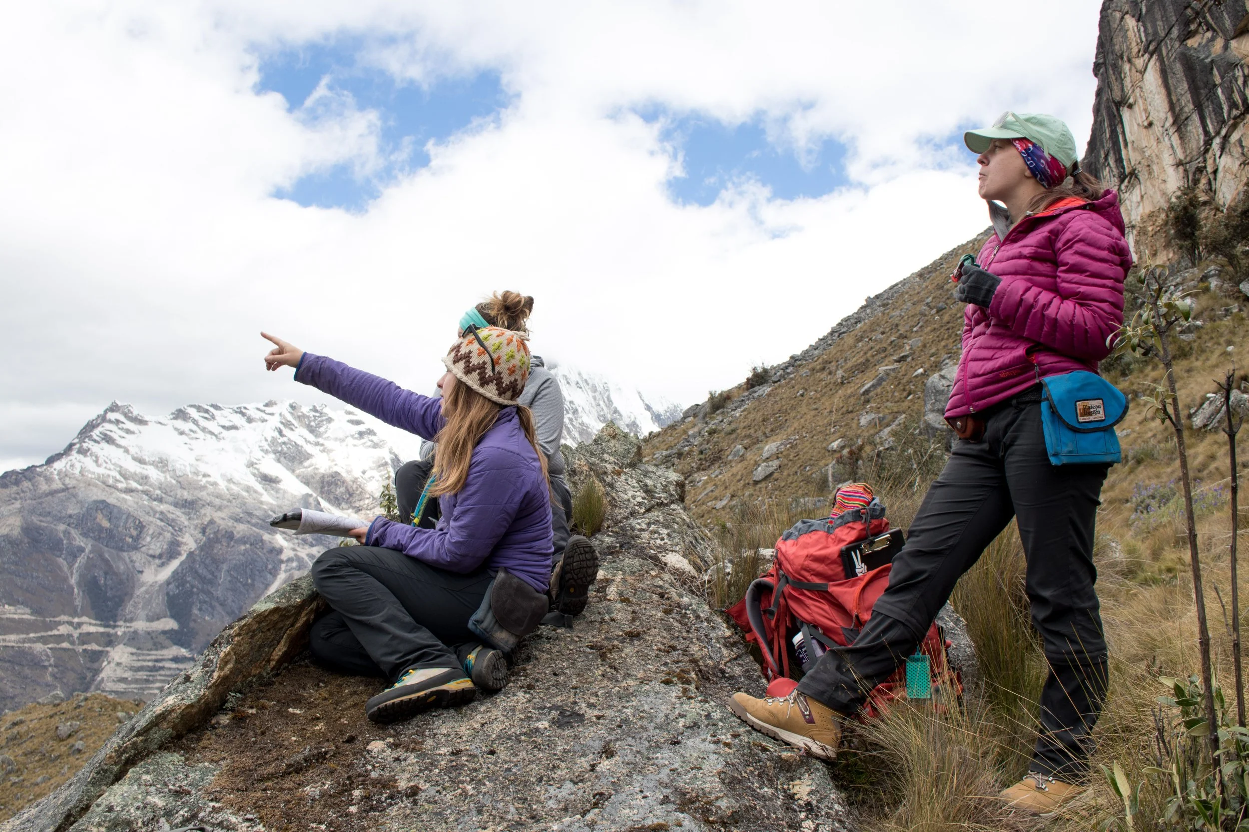
THe first day mapping in the cordillera blanca with two students.
I have been lucky enough to attend or teach seminar-style classes throughout the western US and parts of Central (Guatemala and Belize) and South America (Argentina) and they will hopefully remain a part of my curriculum anywhere I teach.
Regional and international field trips are incredibly effective not only as learning tools, but also as bonding exercises for students and professors alike. Seminar trips are where friendships and future collaborations (and new project ideas!) are born.

hiking in central iceland.
Future Classes
There are many classes I would be interested in teaching, given the time and appropriate students. My expertise in sedimentology, structural geology, field mapping, and basin analysis would allow for many options, but some of my favorites are listed below.