
I am a regional geologist who specializes in sedimentology, structural geology, geo-thermochronology, and geochemistry of integrated basement and basin systems to reconstruct the 4-dimensional evolution of orogens. Much of my work is centered on geologic mapping and stratigraphic analysis in the mountain ranges of western North (Utah, Wyoming, Montana, British Columbia, the Yukon Territory) and South America (Mendoza, Argentina and Ancash, Peru). I have worked extensively with the Utah Geological Survey to develop 1:24k scale maps of the northern Wasatch Mountains. Those maps are vital to state, regional, and city planners to determine geologic hazards and the potential for economic resources in our area. Geologic mapping requires an understanding of the entire geologic history of the region, from 2.45 billion-year-old metamorphic basement evolution to modern activity on the Wasatch Fault. My expertise in stratigraphy and geochronology have been put to work on everything from Precambrian basement to Miocene volcanic deposits. Many of these projects have involved WSU undergraduates who worked with me both in the field and lab to better understand out surrounding geology.
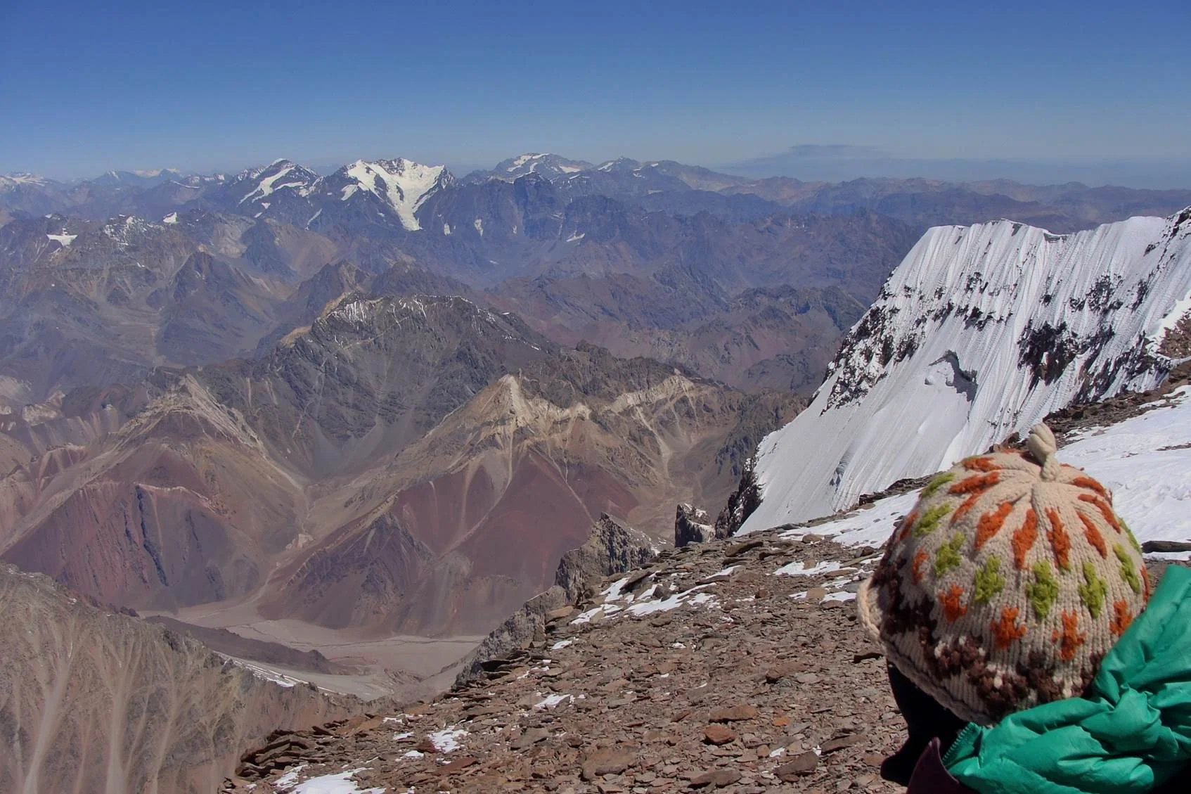
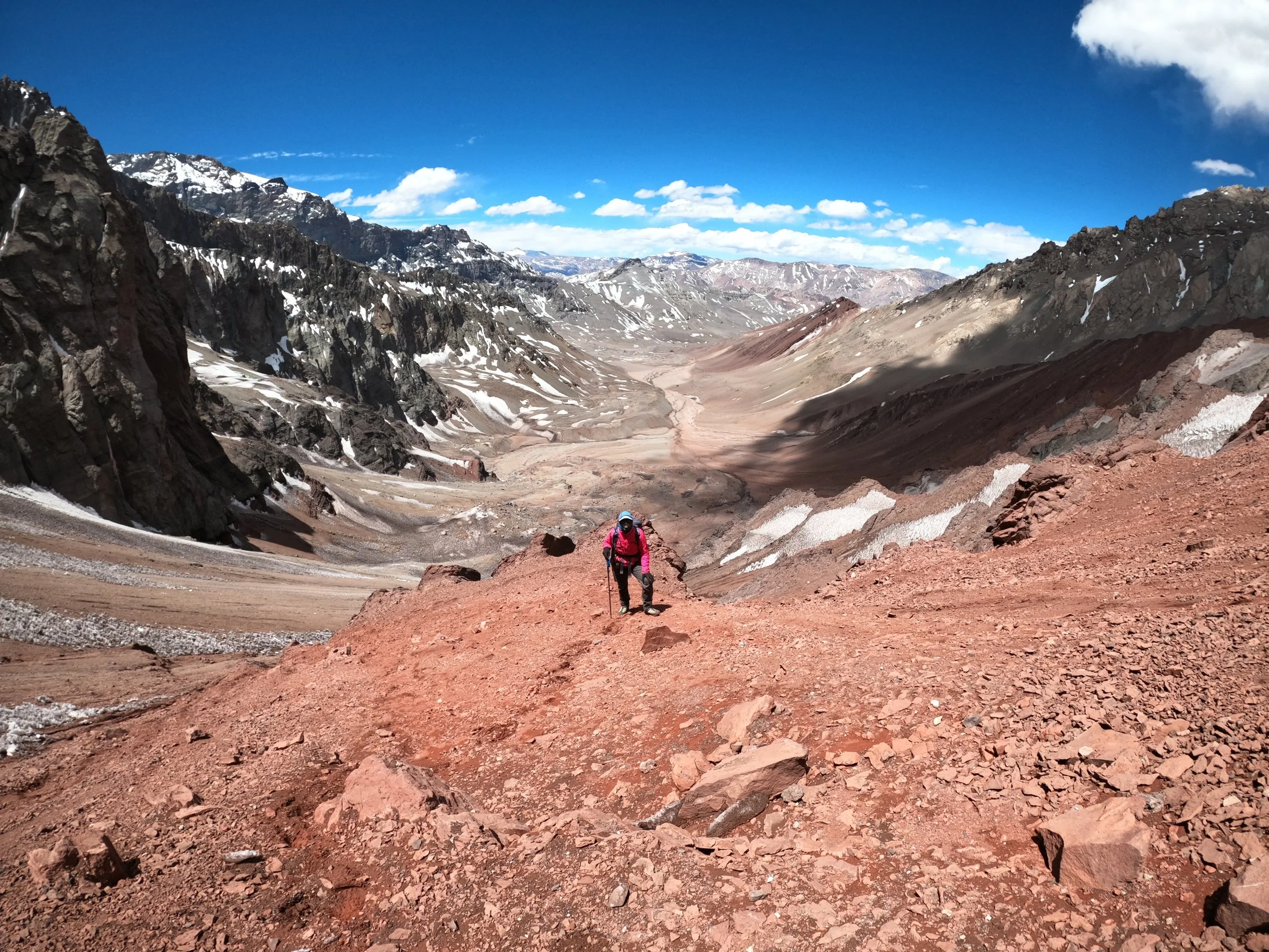
looking down from the summit of aconcagua towards the cretaceous stratigraphic section of interest.
Active Projects
Regional Projects in the northern US Rocky Mountains
Paleoproterozoic evolution of western North America, insights from the Farmington Canyon Complex basement units
The Farmington Canyon Complex (FCC) is comprised of Precambrian igneous and metamorphic rocks, exposed in the northern Wasatch Mountains, that record continent growth during the tumultuous Paleoproterozoic Era (spanning 2.5-1.6 billion years old (Ga)). The transition from the older Archean to Paleoproterozoic Era at 2.5 Ga marks perhaps the most fundamental change in Earth systems, with growth of the first supercontinents, possible onset of plate tectonics, initial rise of atmospheric oxygen, and rapid shifts in global climate (first ‘Snowball Earth” glaciation). The FCC also lies between multiple Archean and Paleoproterozoic craton blocks, providing a critical link for understanding how crustal collisions formed ancestral North America. Although general rock types within the FCC have been described, including granitic gneiss, amphibolites, and paragneiss that formed from metamorphism of granite intrusions, mafic (basalt) dikes, and sedimentary rocks, respectively (Bryant, 1988; Yonkee et al., 2000), the geologic significance of these rocks remained incompletely understood. Prior geochronologic (geologic dating) for parts of the FCC indicated a complex history, with inherited Archean components, multiple phases of igneous intrusion, and Proterozoic metamorphism. However, large parts of the FCC remained undated and poorly understood geochemically. These limitations led us to begin a systematic study of the FCC, which is ideal for involving undergraduate students in research.

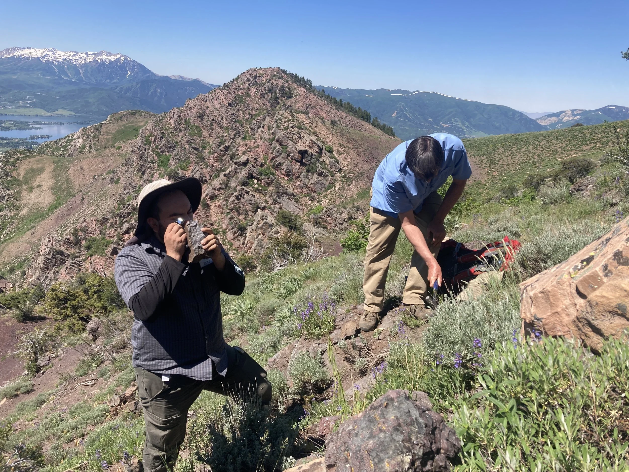
farmington canyon complex exposures in Ogden canyon, ut.
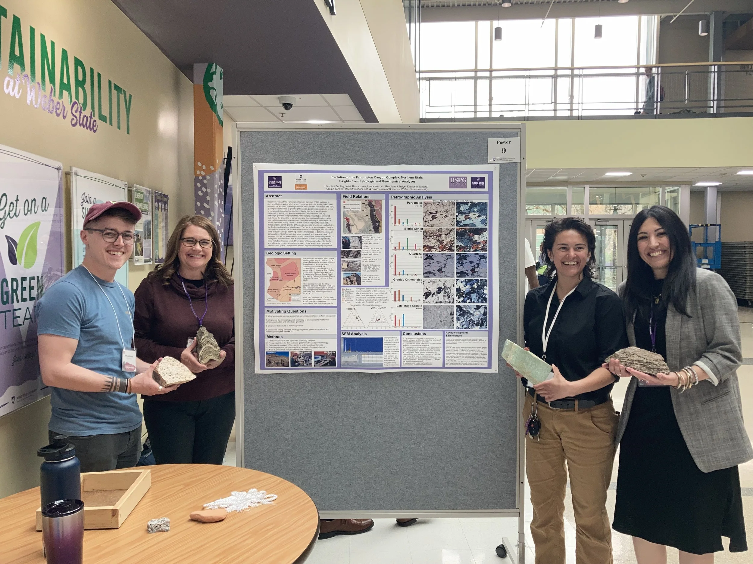
students presenting their research on the farmington canyon complex at an undergraduate research symposium at wsu. All of these students also presented at regional an national geology conferences.
Neoproterozoic to Cambrian evolution of western Utah
Thick successions of Neoproterozoic (1000-540 million year ago) to early Cambrian (585-540 million years old) sedimentary rocks exposed in the northern Wasatch Range in Utah contain the record of extreme tectonic, climatic, and biological events. These include the rifting of a supercontinent, global glaciations, and the proliferation of multicellular life. Although general rock types and correlations have been established for the area, depositional ages, spatial and temporal variations in provenance, and tectonic and setting are incompletely understood. Additionally, there have been no Ediacaran (535-542 million years ago) fossils recorded in these sections, even though they are the same age as important fossil beds globally, recording the expansion of soft-bodied multicellular life immediate before the major diversification of hard-bodied multicellular life in the Cambrian. Thus, fundamental concepts of the history of North American, such as rift timing, paleogeographic and evolution of the margin, and the interrelations between tectonic and biologic changes globally remain incompletely understood.
There are world-class exposures of late Neoproterozoic (Ediacaran) rocks exposed in the northern Wasatch Mountains, Ogden Valley and the Bear River Range. I am working on a join study with other WSU faculty, researchers at Utah State University, the Utah Geological Survey to map, and faculty and students from the University of Sonora in Mexico to describe, date and interpret those units in Ogden Valley. The goal of this project will be to describe these units in detail, work to identify fossils within the stratigraphy, and collect samples for geochemical and geochronologic analysis and in order to correlate them with equivalent section around the world (particularly the Caborca Block in Mexico).
looking at the volcanoclastic deposits from the brown hole formation in the southern bear river range.
Mesozoic to early Cenozoic evolution of the North American Cordillera
Stratigraphic and structural relations of synorogenic strata deposited in basins in northern Utah constrain the timing, location, and magnitude of mountain building. This project combined new geologic mapping, conglomerate clast counts, sandstone grain point counts, and detrital zircon data from proximal Cretaceous to Paleogene sedimentary units deposited just east of Salt Lake City, near Little Mountain, UT. New mapping has identified four distinct conglomeratic packages in the study area that were previously mapped mostly as the Tertiary Wasatch Formation. New unit identification is primarily based on changes in conglomerate clasts that have also been identified in correlative strata to the east. Conglomeratic units overlie Paleoproterozoic basement and folded Paleozoic-Jurassic rocks in the Wasatch Mountains with angular unconformity, and comprise from base to top: (i) proximal facies of the Aptian to Turonian Kelvin and Frontier Formations; (ii) coarse conglomerates with local grown relations along the East Canyon backthrust correlated with the Echo Canyon and Weber Canyon Conglomerates; (iii) boulder conglomerate above an unconformity that thickens northward and is interbedded with finer-grained strata correlative with the Maastrichtian-Paleocene Evanston Formation; and (iv) polymict conglomerate with lenses of lacustrine limestone correlative with the Eocene Wasatch Formation. Preliminary U-Pb geochronologic analysis of detrital zircon in samples of synorogenic strata show “classic” North American zircon populations originally sourced from the Yavapai-Mazatzal, Mid-continent rhyolite, Grenville, and Appalachian basement provinces, along with an apparent lack of Cordilleran arc-sourced grains. Patterns are consistent with unroofing of multiple stratigraphic levels across frontal and piggy-back thrust sheets, recycling from erosion of previously deposited synorogenic strata, and development of a topographic barrier along the Wasatch anticlinorium that separated the foreland basin in this area from sources in the hinterland to magmatic arc, whereas arc-sourced grains are common in correlative synorogenic strata farther north and south.
New work with collaborators from the University of Indiana has shown that much of the sand within the Paleozoic and Mesozoic rocks in the northern Wasatch Mountain originated in the Appalachian Mountains far to the east while they were at their highest. U-Th/He dating allows us to determine the timing of uplift of the Appalachian Mountains by looking at sediments deposited in Utah.
Cenozoic volcanism and basin evolution of the Wasatch back
The Norwood Tuff is an Eocene volcaniclastic package present in Ogden and Morgan valleys of northeastern Utah. The age of the Norwood Tuff was previously constrained using K-Ar and mammalian paleontology techniques, and was potentially correlated with the Keetley Volcanics to the south. However, previous ages are based on outdated techniques and are spatially and stratigraphically limited. We collected and analyzed a range of samples for zircon U-Pb geochronology within the type section in Norwood Canyon (n=8), and an equivalent package in Porterville to the west (n=11), covering ~8 km from west to east and at least four separate stratigraphic intervals. Zircon U-Pb ages were obtained using LA-ICP-MS at the Arizona Laserchron Center and a subset of additional grains were targeted for Hf isotopic and trace element analysis. We complement these analyses with detailed sedimentological descriptions of the units, thin section petrographic, and whole rock geochemical analysis. Preliminary results indicate that the unit previously mapped as the Norwood Tuff contains strata deposited during at least three separate volcanic intervals, between 42 and 40 Ma, 22 Ma, and ~9 Ma.
Cordillera Blanca, Peru
The Cordillera Blanca, in Peru, contains the highest concentration of tropical glaciers in the world and is the highest-elevation section of the northern Andes Mountains. The low latitude of the Cordillera Blanca makes the glaciers more susceptible to the overall warming trend over the past few decades and the region has been experiencing rapid deglaciation. The extreme topography of the Andes Mountains, also generates a rain shadow making the western, much more populated portion of Peru, a desert. Therefore, glacial runoff and snowmelt from the mountains are the primary source of freshwater for the western portion of Peru, so water quality and quantity coming out of the Cordillera Blanca is crucial both locally and nationally. As the glaciers recede, a zone of heavily mineralized rock is being exposed. This rock contains pyrite and other sulfide minerals, which cause water contamination. I worked with students to map drainages within the Cordillera Blanca to identify the extent of the mineralized zone and assess the control of bedrock geochemistry on water chemistry. This mapping has allowed us to predict where water contamination may get worse as the glaciers continue to recede. This project is part of an interdisciplinary project to document the impact of climate change on high alpine ecosystems. Along with the research aspect, this project also includes a class for undergraduate students to learn how to conduct scientific field research in challenging settings. This work was presented by students multiple professional meetings.
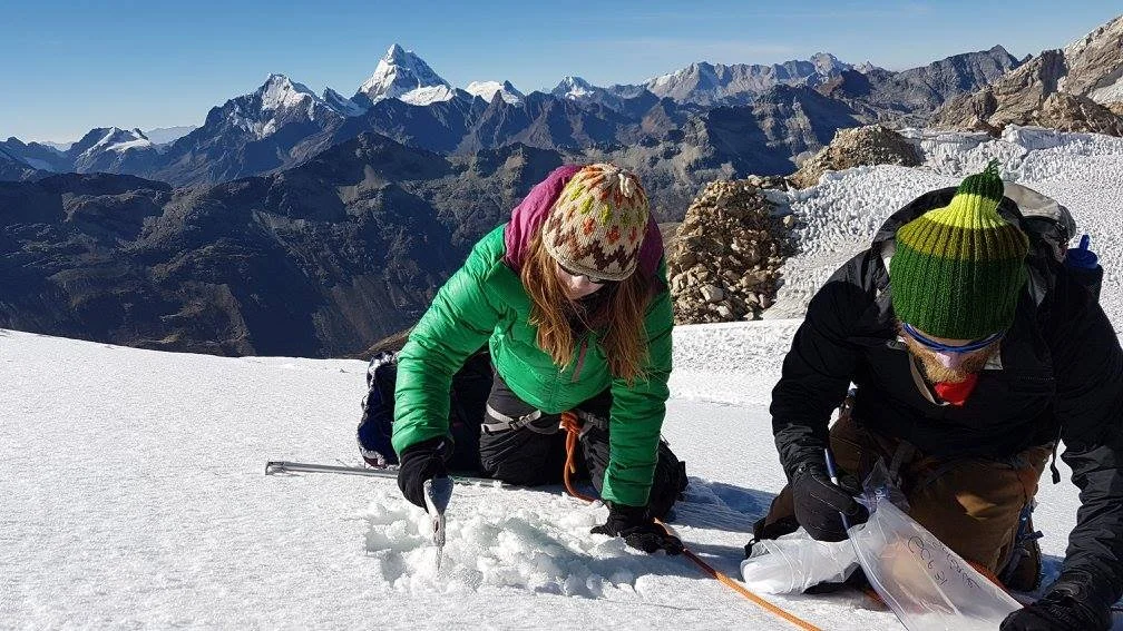
collecting snow samples on the descent from Ishinca.
Southern Central Argentinian Andes
The Andes Mountains, at over 7000 km long, are the longest mountain chain on Earth and contain the highest peak (Cerro Aconcagua: 6962 m) in the western and southern hemispheres. Located on the east side of the Pacific Ring of Fire, well known for earthquakes, volcanoes, and tsunamis, the Andes are a constant reminder of the ongoing collision between the various fragments of the Pacific plate and South America. Uplift within the Andes is temporally and spatially variable leading to questions regarding the underlying controls of the rate and timing of mountain building. Near the base of Cerro Aconcagua, 250- to 65-million-year-old rocks contain evidence of the onset of compression and uplift within this section of the Andes. However, the exact timing and the magnitude of different uplift events have not been quantified, making it impossible to determine these rates over time. This study will apply cutting edge techniques, including laser ablation and fission track analysis, to precisely determine the timing and amount of initial uplift of the rocks in the field area, allowing for more accurate paleogeographic reconstructions and direct comparisons to modern shortening rates. A detailed understanding of the regional geology is necessary to fully assess the potential for and extent of natural resources and geologic hazards.

boulders along the rio horcones in central argentina.
collecting samples above plaza argentina in aconcagua provincial park.